Room for the Rivers
The Idea of the Project
Further sea level rise due to climate change increases the risk of flooding of the rivers and is likely to lead to coastal decline of habitat for native species, as the area is densely populated and there is only limited opportunity for creating new nature reserves.
The Room for the River project is an ambitious and large-scale project to proactively deal with climate change. This is supported by a drive from the national government to reduce flood risk, with significant funding available to deliver this. The primary objective is to protect homes and businesses from flooding. It enables greater storage of river floodwater, heightening of coastal dunes and manmade defenses to protect the coast against storm surges and it thereby also provides major benefits for biodiversity through habitat creation and more natural approaches to flood defenses.

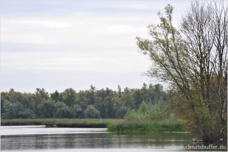
The Biesbosch Marshes
(Photo: Ralf Schulte, NABU)
The Biesbosch Marshes
In the morning the Biesbosch Marshes were visited as an example of a climate adaptation project. Here, additional space has been created for the river flooding, which has a high priority in the Netherlands. There are several ways to give more room for the river (such as deepening the summer bed, create high-water channel, reinforcing the dike). The project was presented by Jacco Zwemer, project manager of the Directorate General for Public Works and Water management (Rijkswaterstaat) at the site visitor centre. He emphasized the effects of the depoldering of the Spiering Polders in the central part of the Biesbosch. To enable this, the dike on the riverside of a polder is relocated land inwards. By doing so, the water can flood into the area at high water levels. Over 900 hectares of wetlands has been realized. The farmers and householders affected have been closely consulted, although some are deeply unhappy about having to move, and no secret is made of this in the centre’s video material. There are 1.5 million visitors per year so many people enjoy the site.
This national park and Natura 2000-site covers an area of approximately 9.000 hectares. The Biesbosch was one of the very rare remaining freshwater tidal zones in Europe. It is situated east of Holland’s Diep in the Rhine-Meuse-Delta. It developed from huge amounts of sand and silt the rivers transported from upstream, which were deposited at the turn of the tide. The sandbanks were used as farmland for centuries. Nowadays the vegetation consists of various species of willows from former cultivation, alternating with reed and pasture. The Biesbosch area is very important for breeding and resting birds and it is home to beavers again. They were re-established from the Elbe region in 1988 (extinct in the Netherlands since 1825). The city of Rotterdam uses the Biesbosch as a drinking-water reservoir and recreational area.

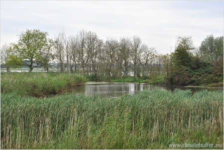
Biesbosch Ponds
(Photo: Ralf Schulte, NABU)
Island of Tiengemeten
Tiengemeten is situated in the Haringvliet (part of the Rhine-Meuse-Deltastream) and is the property of an insurance company. Since 1997, Natuurmonumenten manages the island with help from the Dutch government. The management objectives are to restore estuarine habitats and processes as far as possible with the existence of the Haringvliet Sluice. Together with the Haringvliet and Biesbosch Marshes, it is part of the Room for the River project. It is also part of the government’s National Ecological Network (EHS in Dutch). Both the Room for the River Project and the National Ecological Network aim at the development from an agricultural to a natural landscape at this site. The Masterplan for Tiengemeten, which was designed by a steering committee, took into account the different requirements such as the restoration and the development of nature, recreation and the value of cultural historic features.
Most of the island (700ha) was a polder landscape which was used as farmland. All the farmers have left as their relocation and compensation was finished in 2005. Since then, the island has been dramatically altered. To provide room for the tide, most of the island is now connected directly with the Haringvliet by a tidal creek. A new dike has been built around approximately one-third of the island, including the main group of buildings. The higher parts are accessible for visitors by pathways and viewpoints. This resulted in two different wetlands: one with, and one without an open connection with the river Haringvliet. The first estuary is connected with the Haringvliet which causes its water to be brackish and the water level to be dependent on the tides. The second estuary is bound to the influence of rainfall and the water level therefore varies in an annual cycle.
The island Tiengemeten was explored by bike. The island is managed by Natuurmonumenten. Here, some of the river defenses have been breached to allow greater storage of floodwater at peak times as part of the ‘Room for the River’-project. Natuurmonumenten has carried out extensive public consultation about its climate adaptation project. There was an elaborate consultation and management planning exercise using a matrix of Alternative Development Options, ranging from an almost inaccessible tidal landscape to a combination of tidal habitats, residential area and recreational opportunities. At Tiengemeten the creation of new estuarine habitat has led to a loss of farmland.
By returning farmland back into nature’s hands, an interesting nature reserve has been created. The process was actively helped by digging up sediment to create raised areas and variation in relief. Besides a valuable wetland habitat, the island also functions as an economical and recreational site for environmental education. The projects in the Biesbosch Marshes and Tiengemeten have allowed the creation of valuable wetland habitat supporting populations of wading birds and other species, in a densely populated delta.

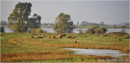
Cattle Grazing on the Island of Tiengemeten
(Photo: Ralf Schulte, NABU)
The project started in 2010 and was finished in 2012.